Regional Mars Maps

I show specific regions of Mars, based on the regions I used for my index map

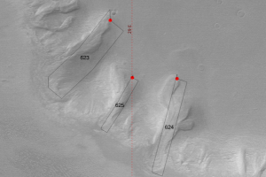
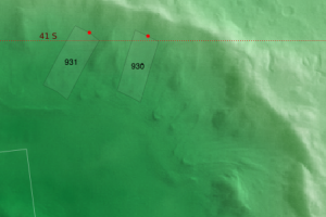
I show the HRSC DTM tiles in outline, with the data from the Mars Global Surveyor MOC image mosaic with the Mars Orbiter Laser Altimeter topography used via colour coding. The Souness et al. 2012 glaciers are shown with their extents outlined.

Northern Hemisphere

Southern Hemisphere

Mareotis Fossae

Individual pages on the Souness glacier-like forms in this region are shown below

Colour-coded elevation, blended with Mars Orbiter Camera images

With classifier results shown

Here I show the classifier result, for both the 'head' and 'extent' areas in red and blue respectively. Again in many HRSC tiles this has not successfully rendered, therefore the HRSC nadir image alone is shown in greyscale.

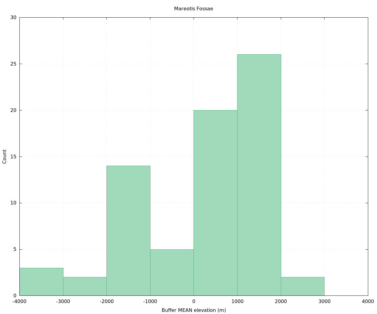
There are a total of 72 Souness GLFs in this region. See also the scatter plot at filtergraph.com/2101390

Histogram by elevation of Souness GLFs in Mareotis Fossae region
Displaying the histogram of numbers of Souness GLFs as a function of elevation within the Mareotis Fossae region.

Links to individual pages on Souness GLFs in this region

Souness 7
Souness 8
Souness 9
Souness 10
Souness 11
Souness 12
Souness 13
Souness 14
Souness 15
Souness 16
Souness 17
Souness 18
Souness 19
Souness 20
Souness 21
Souness 22
Souness 23
Souness 24
Souness 25
Souness 26
Souness 27
Souness 28
Souness 29
Souness 30
Souness 31
Souness 32
Souness 33
Souness 34
Souness 35
Souness 36
Souness 37
Souness 38
Souness 39
Souness 40
Souness 41
Souness 42
Souness 43
Souness 44
Souness 45
Souness 46
Souness 47
Souness 48
Souness 49
Souness 50
Souness 51
Souness 52
Souness 53
Souness 54
Souness 55
Souness 56
Souness 57
Souness 58
Souness 59
Souness 60
Souness 61
Souness 62
Souness 63
Souness 64
Souness 65
Souness 66
Souness 67
Souness 68
Souness 69
Souness 70
Souness 71
Souness 72
Souness 73
Souness 74
Souness 75
Souness 76
Souness 77
Souness 78

Links to HiRISE images with Cornish titles

As part of the HiRISE Kernewek website at the University of Arizona, the following HiRISE images have been described in Cornish. Some have red/blue 3D analgyphs which have not yet had Cornish titles added.

Kowdoll war Amal Islonk
Lat: 26, Long: -100
Kowdoll a dermyn dororiethel a-dhiwedhes
Lat: 49, Long: -100
Ow korwolyas kowdoll rewek
Lat: 51, Long: -95
Pyttow war Leur Kowdoll y’n Ranndir Alba Patera
Lat: 55, Long: -93
Plenys Kosel a'n Wogledh a Veurth
Lat: 65, Long: -90
Lobo Vallis
Lat: 27, Long: -61
Savnow gans Lesansow Bras a Wodhes
Lat: 60, Long: -58
Saven war Nilokeras Scopulus
Lat: 34, Long: -54
Kowdoll gans Runyow Serth
Lat: 29, Long: -40
Red/blue 3D anaglyph

Last updated 11th September 2019. davidtreth[at]gmail.com