Digital Terrain Model layerstack on Mars
Tags: QGISMarstuiviewHiRISEDTM16 Jun 2014 - MawKernewek
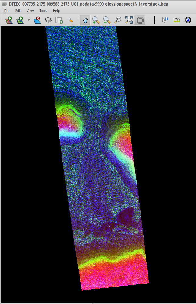
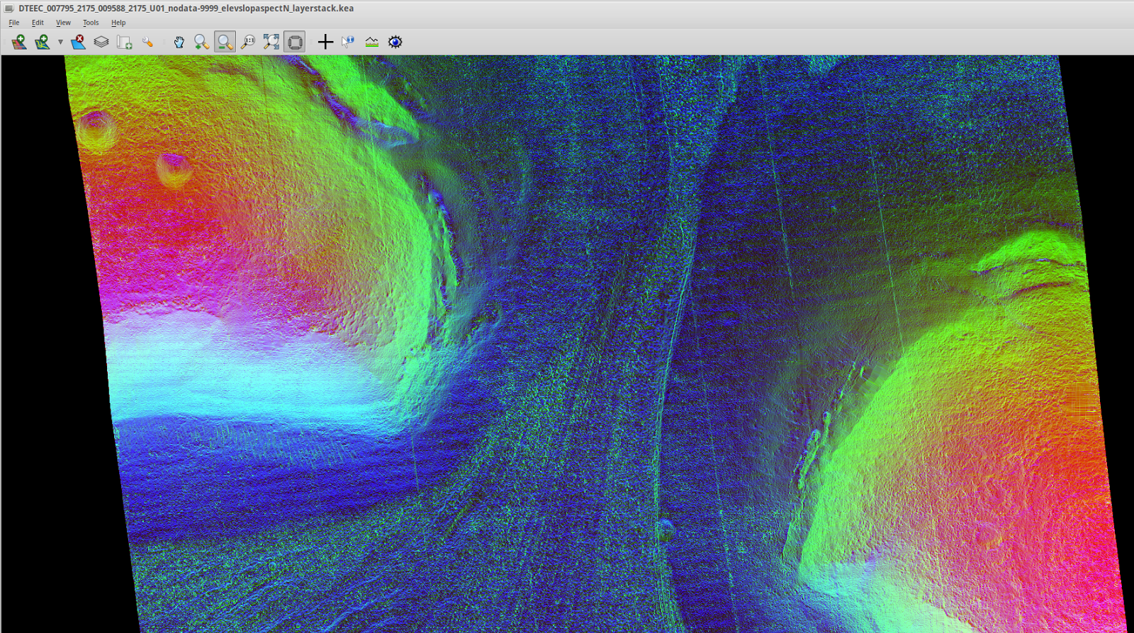
I've begin to look at topographic analysis on Mars. Here's a HiRISE digital terrain model, with red coloured for higher elevations, green for steeper slopes, and blue for aspect.
This one is a Lineated Valley Fill in Deuteronilus Mensae.
Data from HiRISE website (NASA/JPL/University of Arizona/USGS) processed in GDAL and shown in Tuiview.
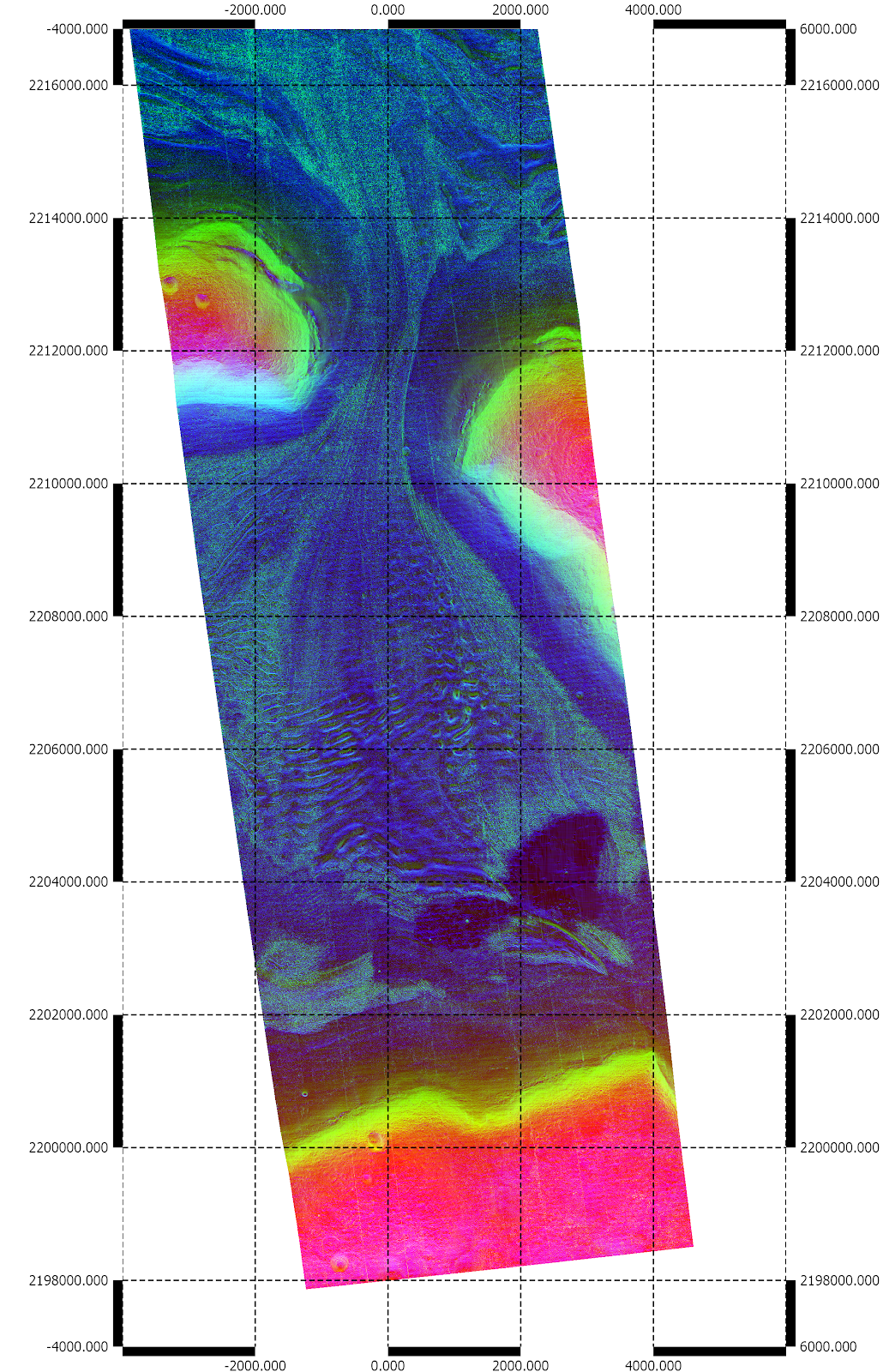
Edit - Importing into QGIS, showing the scale using a grid (units are in metres):
The elevation range is from -2681 to -1997 metres relative to Mars datum, and I've coloured slope in the range 0-30 degrees, and aspect 0-180 deg away from N.
This one is a Lineated Valley Fill in Deuteronilus Mensae.
Data from HiRISE website (NASA/JPL/University of Arizona/USGS) processed in GDAL and shown in Tuiview.
Edit - Importing into QGIS, showing the scale using a grid (units are in metres):
The elevation range is from -2681 to -1997 metres relative to Mars datum, and I've coloured slope in the range 0-30 degrees, and aspect 0-180 deg away from N.