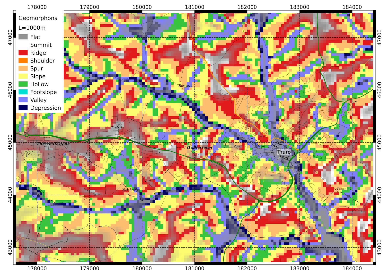
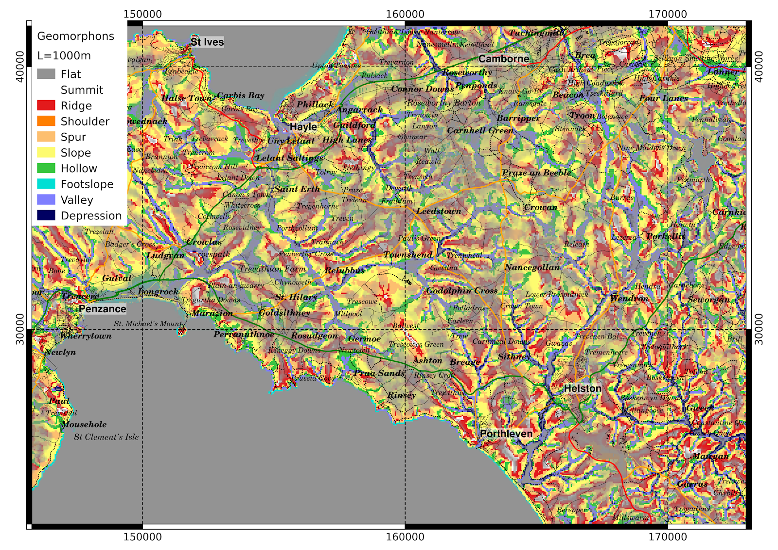
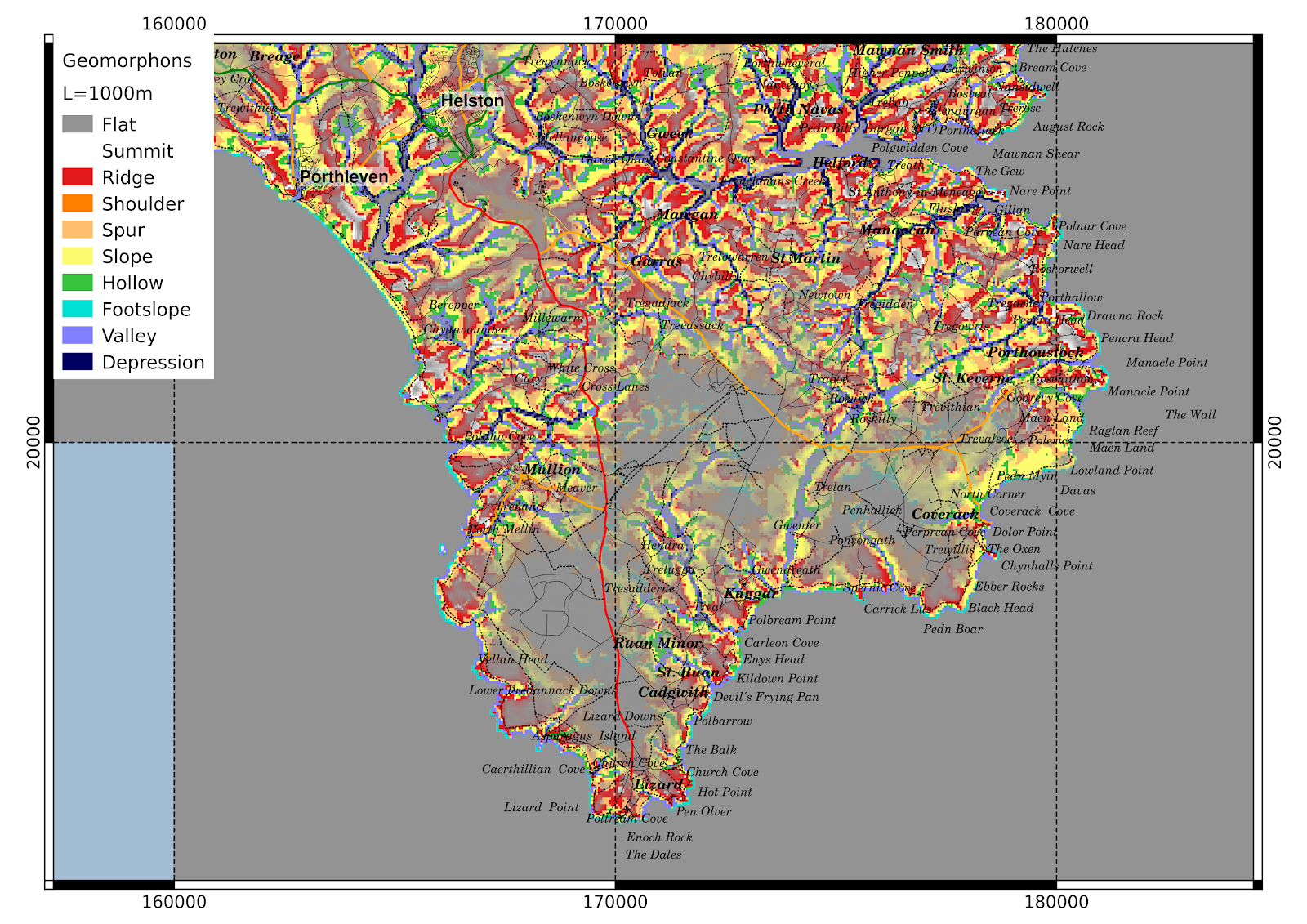
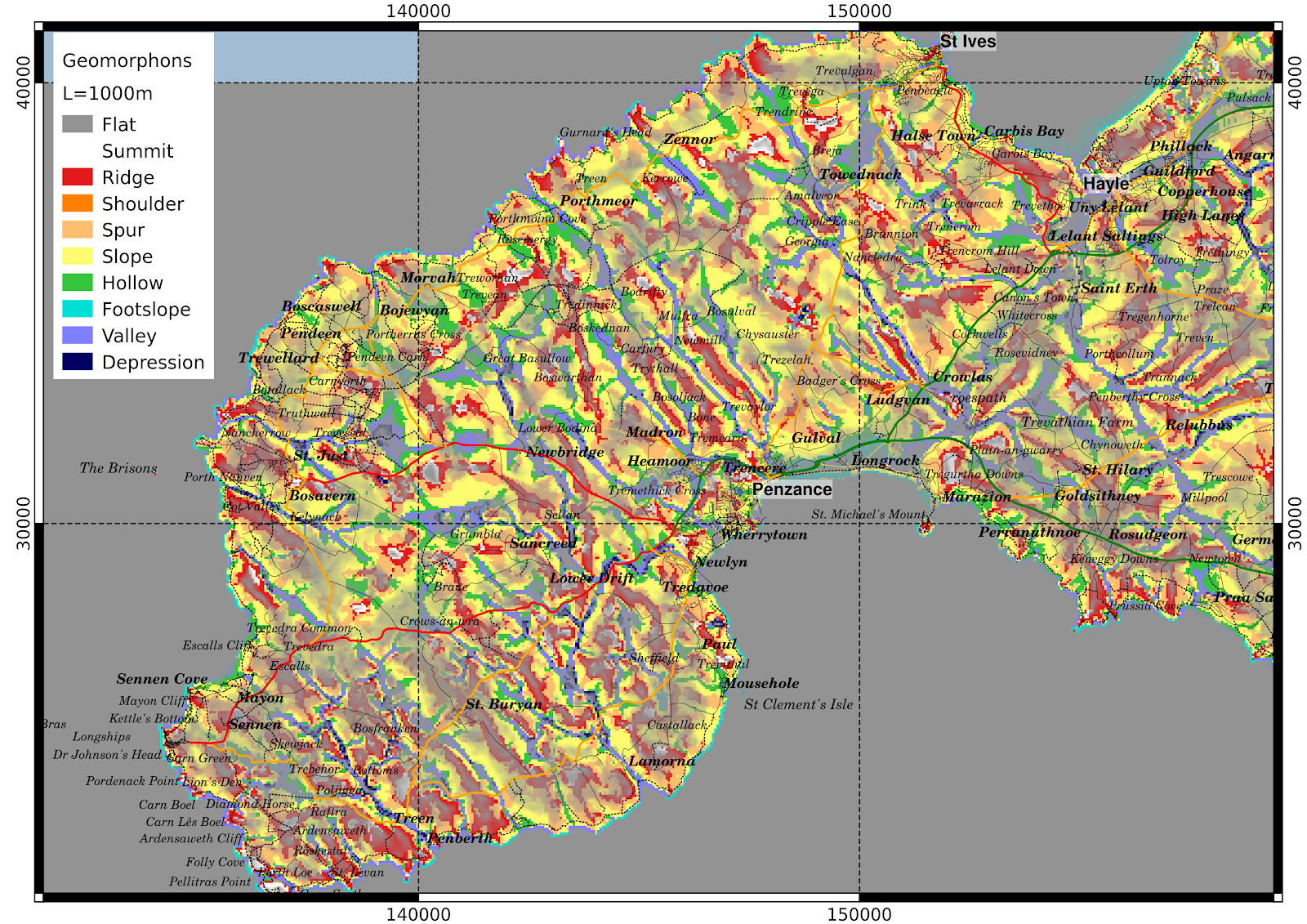
A few more geomorphon maps
Tags: geomorphonsDTM08 Jan 2015 - MawKernewek
One of the problems with the maps in my last post is that the vertical scale of the landforms is completely lost, it is impossible to tell whether a slope is shallow or steep.
A possible way to bring this information back is to grey out the shallowest slopes which I have done progressively for slopes less than 5 degrees in the maps below:


A possible way to bring this information back is to grey out the shallowest slopes which I have done progressively for slopes less than 5 degrees in the maps below: