Galactic Information Systems
Tags: andromedaQGIShumour08 Jun 2015 - MawKernewek
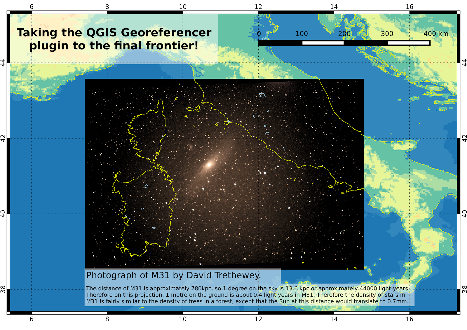
Then with the aid of a star chart, find a few reference points, and use SIMBAD to find coordinates for then. I used the M31 centre, the satellite galaxies M32 and M110, and the stars 35 and 32 And.
The result was that M31 is just off the coast of Italy.
The distance of M31 is approximately 780 kiloparsecs, 1 parsec being 3.09x10¹⁶m. 1 degree on the sky corresponds to 13.6kpc at M31's distance (note that the stars in the image are Milky Way stars and much closer) and that means that 1 metre on the ground translates to 0.4 light years in M31.
Therefore the density of stars in M31 is perhaps similar to the corresponding density of trees in a forest, except of course that the stars are arranged in a 3 dimensional structure, and the stars themselves are vastly smaller then the corresponding trees, the Sun's diameter at M31 distance corresponding to about 0.7mm on the Earth, the size of a small insect.