To have a bit more of a look at the areas that are woodland in OS VectorMap and not classed as woodland in the classification, I here show where these areas are on the satellite images, and the classes that these areas are in fact assigned.
June 2006
 |
| Showing the areas indicated as woodland in OS VectorMap but not by the classification outlined in black, overlaid on the Landsat 7 image from 9th June 2006 (bands 5,4,3). large version |
 |
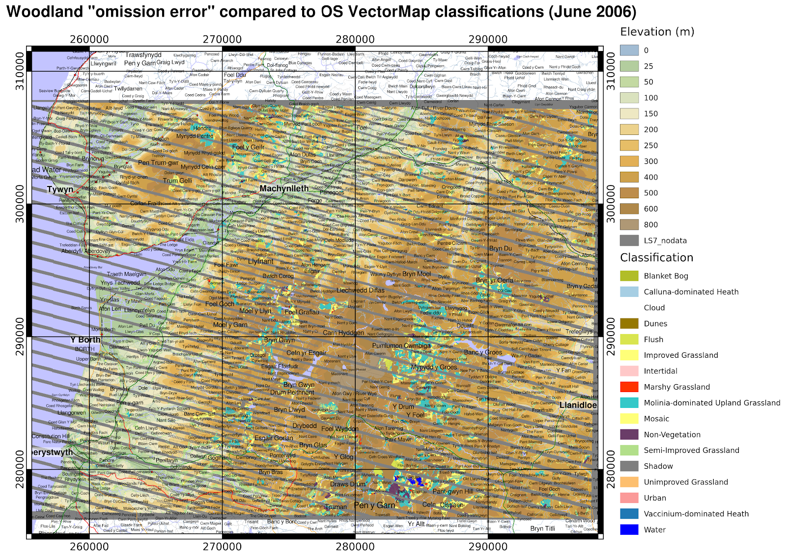
| Showing the actual classifications the "omission error" areas were assigned. large version |
March 2007
 |
| Showing the areas indicated as woodland in OS VectorMap but not by the classification outlined in black, overlaid on the Landsat 7 image from 24th March 2007 (bands 5,4,3). large version |
 |
| Showing the actual classifications the "omission error" areas were assigned. larger version |
September 2013
 |
| Showing the areas indicated as woodland in OS VectorMap but not by the classification outlined in black, overlaid on the Landsat 8 image from 24th September 2013 (bands 6,5,4). Some areas that display in pink here appear to be recently felled forest areas that have a weak reflectance in NIR (shown in green), but strong in SWIR1 (shown in red) with some reflectance in red (shown in the blue channel here). large version |
 |
| Showing the actual classifications the "omission error" areas were assigned, and the 'cloud' areas. Some shaded areas are spuriously being classified as water. large version |