Georeferencing a map from 1574
Tags: QGISwaleshistorical mapsllyfrgell genedlaethol cymrugeoreferencing23 Oct 2015 - MawKernewek
I saw the National Library of Wales had digitised a map of Wales produced circa 1574 by Humphrey Llwyd, and uploaded a copy to Wikimedia commons.
I decided to try georeferencing it to a modern map based on OpenStreetMap data using the QGIS georeferencer:
I chose a variety of places around Wales and the border areas shown on the map, including Cardiff, Newport, St. Davids, Aberystwyth, Holyhead, Liverpool, Shrewsbury, Hereford.
The result looks more accurate than I expected, with Aberystwyth and Shrewsbury being almost exactly referenced, and several other places with small errors.
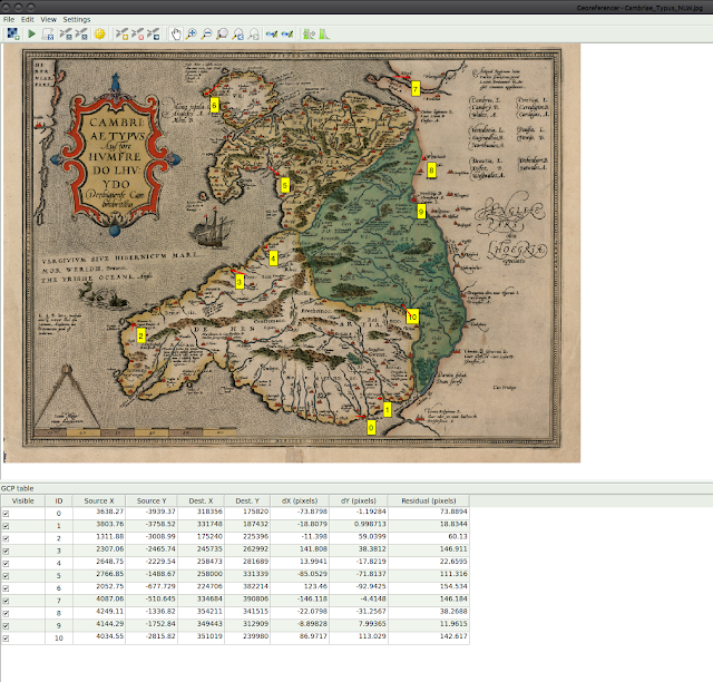
According to the author Graham Robb, Whitchurch in Shropshire was the prime longitude meridian for the British Druids in the Iron Age, and is named as "Mediolanum" by Ptolemy in the 2nd century. Aberystwyth (or more exactly, the Pendinas hillfort) was also an important location within their navigation system apparently, being both on a longitude meridian and latitude paralell.
I decided to try georeferencing it to a modern map based on OpenStreetMap data using the QGIS georeferencer:
 |
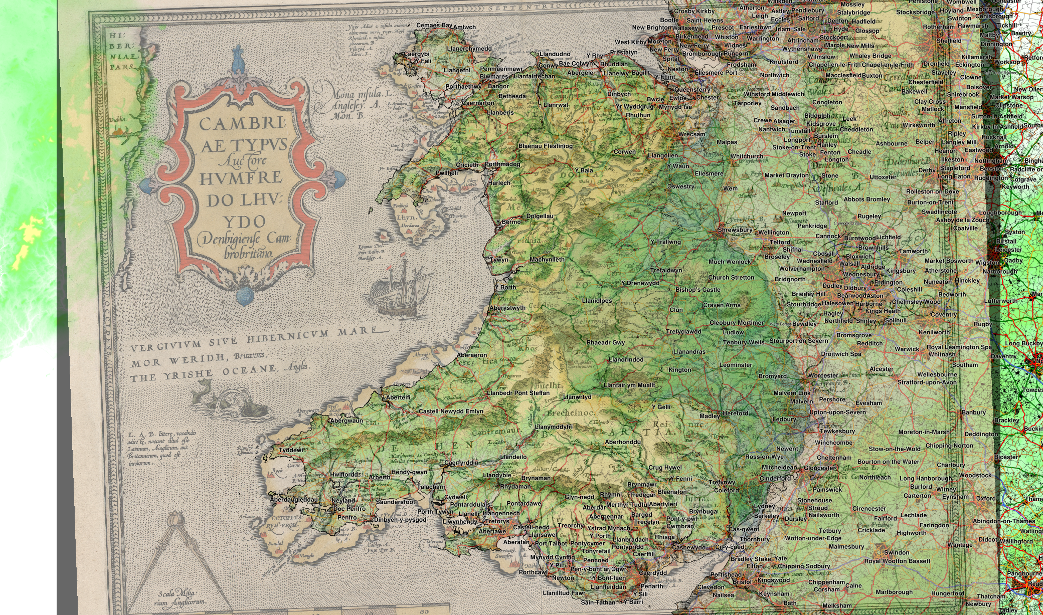
| Overlaying 1574 map with transparency shows the variability in the accuracy of the map. full-size version |
 |
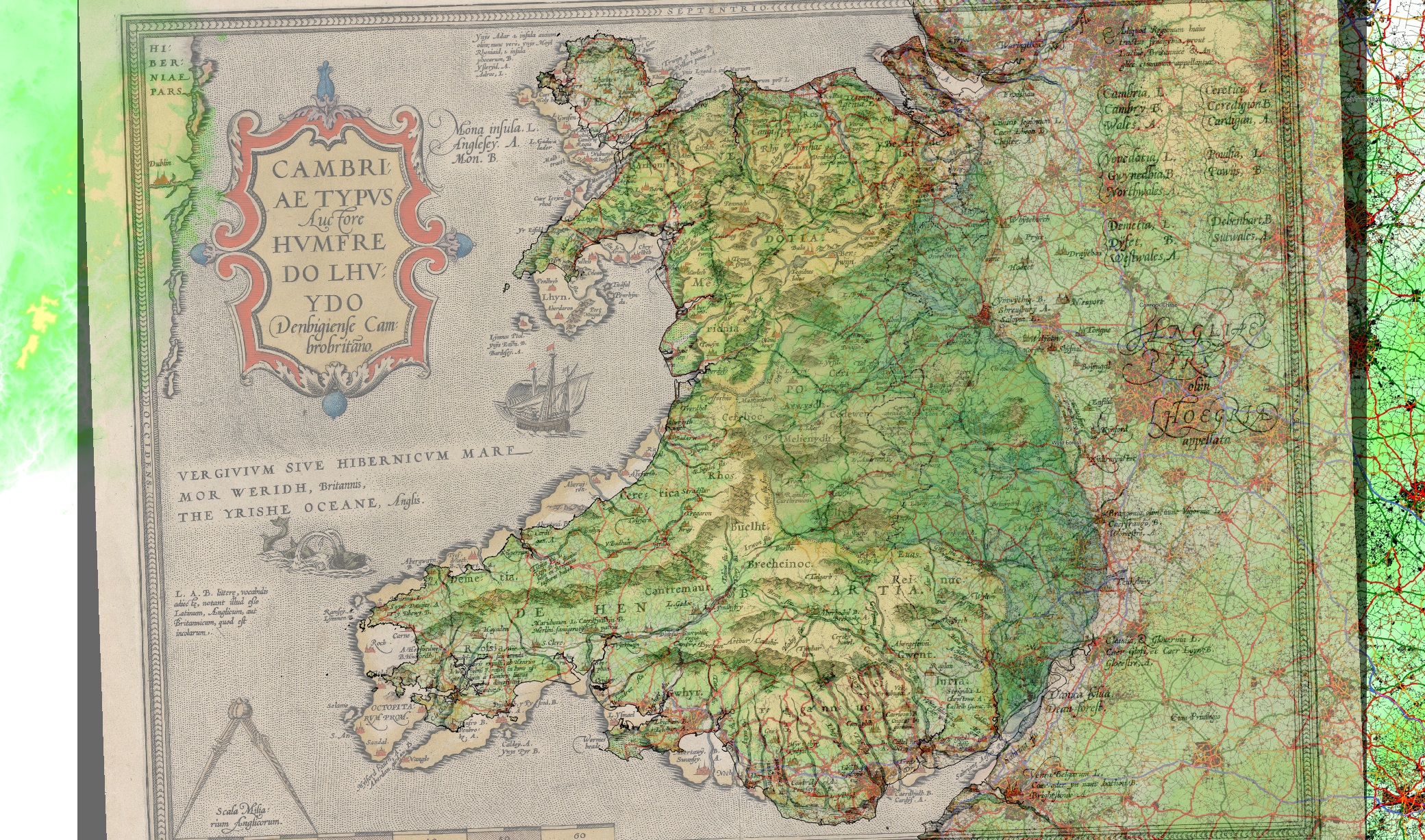
| Removed modern town names to show 1574 map more clearly. full-size version |
I chose a variety of places around Wales and the border areas shown on the map, including Cardiff, Newport, St. Davids, Aberystwyth, Holyhead, Liverpool, Shrewsbury, Hereford.
The result looks more accurate than I expected, with Aberystwyth and Shrewsbury being almost exactly referenced, and several other places with small errors.

According to the author Graham Robb, Whitchurch in Shropshire was the prime longitude meridian for the British Druids in the Iron Age, and is named as "Mediolanum" by Ptolemy in the 2nd century. Aberystwyth (or more exactly, the Pendinas hillfort) was also an important location within their navigation system apparently, being both on a longitude meridian and latitude paralell.
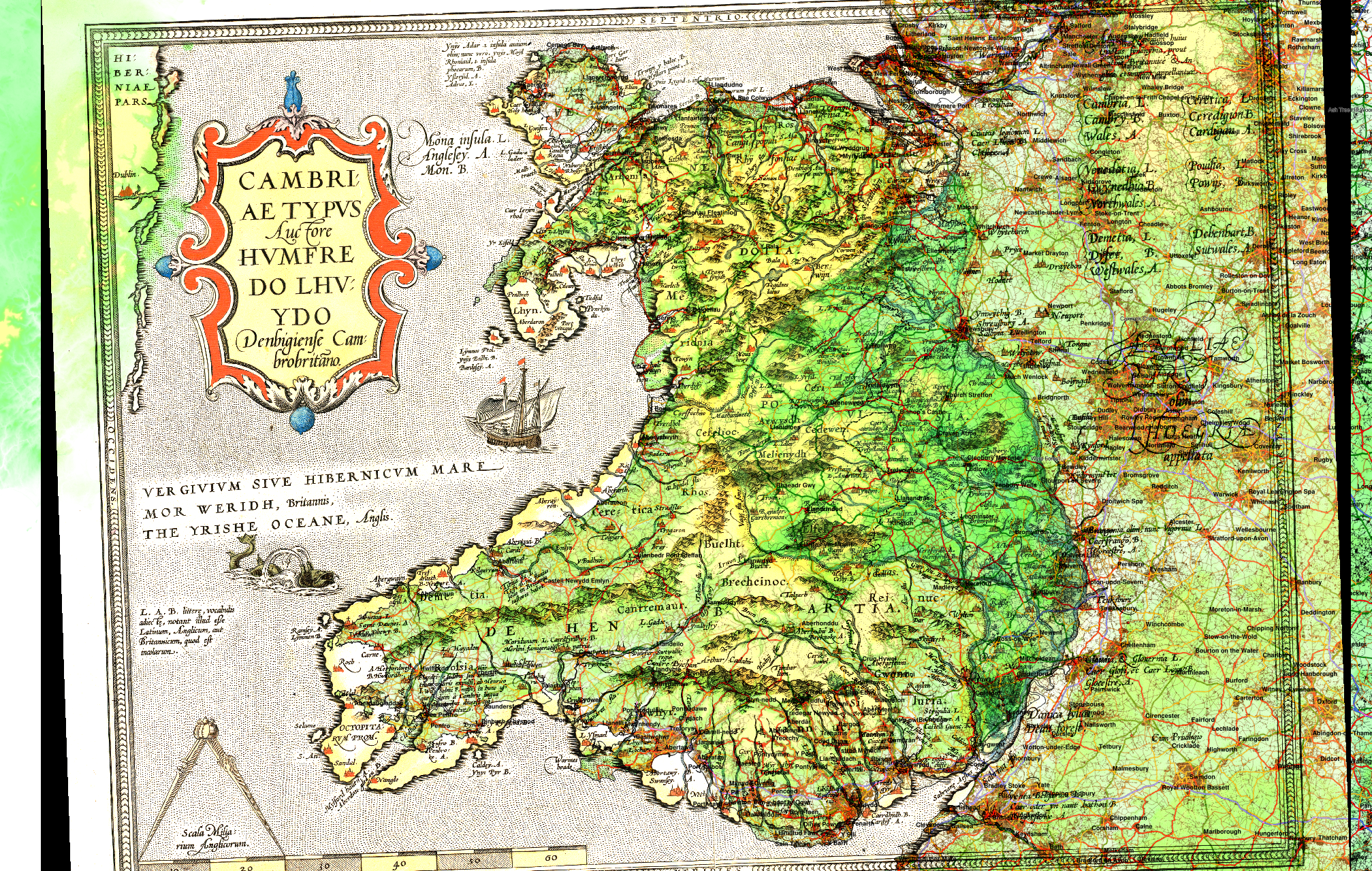
Update: QGIS layer blending
Changing the layer blending method to a "Hard light" overlay rather than semi-transparency makes for a slightly clearer result I think: |
| full-size version |