As I wrote in the last post, I am in the process of dividing up my QGIS projects covering the Mars Express HRSC DTM tiles that cover areas where Colin Souness found 'glacier-like forms' in his PhD and
research paper.
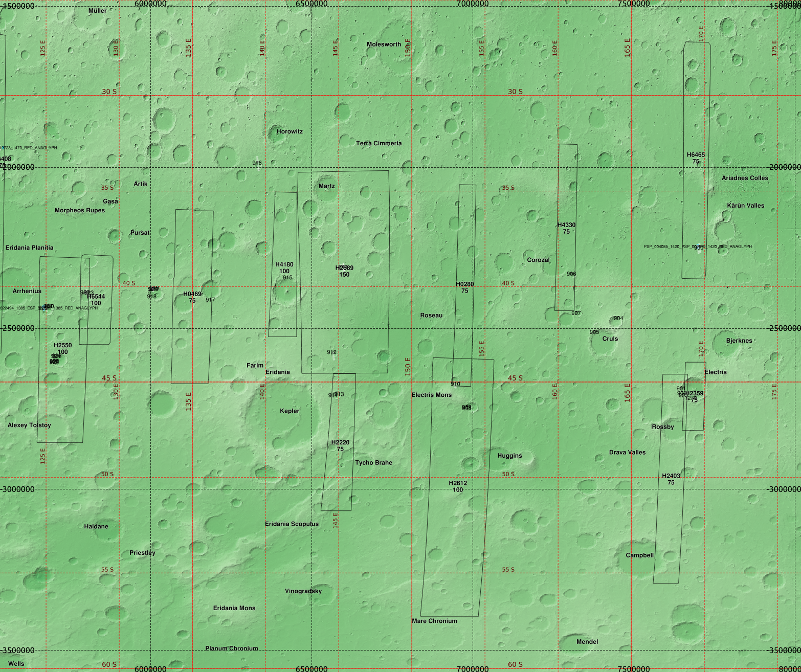
I now come to the southeastern highlands:
 |
| Again, I use the equicylindrical projection optimised for 40° latitude, units are metres. |
 |
| The elevation colour ramp for the underlying backdrop of the MOLA/MGS topography. In the above rendering this is blended with the Mars Orbiter Camera image mosaic. |
 |
| In this region, I am able to use a single colour ramp for all of the various HRSC DTM tiles. |
 |
| The MOLA elevation alone. |
 |
| The MOLA elevation, blended with hillshade. |
There are relatively few Souness GLFs in this region,found in crater walls. There are a number of these that look quite interesting - where within the same crater part of it looks glacial, and other parts have terrain produced by erosion by liquid.
Crater at 125°E, 41°S
 |
| Several Souness GLFs, including one covered by an anaglyph ESP_022494_1385. |
 |
| The classifier results (blue for topographic similarity to 'extent' areas, and red for topohgraphic similarity to 'head' area) overplotted on the HRSC nadir image. |
Crater at 126°E, 44°S
 |
| Several Souness GLFs and other areas showing flow features. Souness 928 appears to have its 'head' and 'terminus' locations interchanged in the catalog. |
 |
| Classifier results. |
Crater at 141°E, 40°S
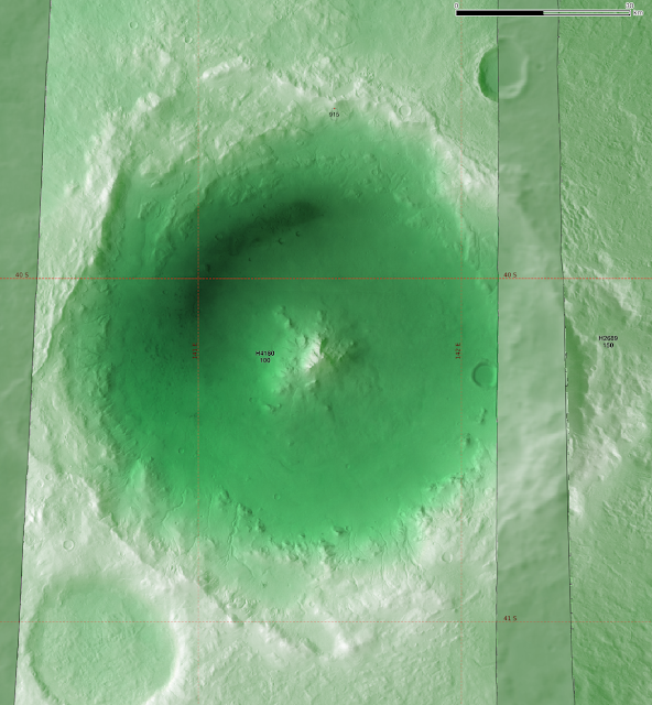 |
| Souness 915 appears in the northern wall of the crater, and fluvial-like channels in the south wall. |
 |
| A closer look at the north wall. |
 |
| The classifier results. |
 |
| The channels visible in the southern wall. |
 |
| Classifier results. |
Crater at 169°E, 45°S
 |
| Four Souness GLFs are found in this crater. |
 |
| With the classifier results. |