Index Map of Martian Glaciers
Map Rewivaow Meurth
Map Rewivaow Meurth
After I produced a few demonstration zoomable maps of Cornwall, I thought I would apply this method to my previous work on Mars.
Firstly here are a couple of hemispherical overviews, with 16384px square maps for the W and E hemispheres of Mars. I use an equicylindrical projection with a reference latitude of 40°. There are also maps of specific regions of Mars, and the Top Trumps pages for individual objects in the Souness catalog.
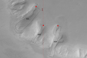
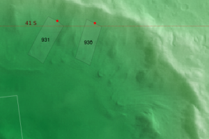
I show the HRSC DTM tiles in outline, with the data from the Mars Global Surveyor MOC image mosaic with the Mars Orbiter Laser Altimeter topography used via colour coding and also hillshading. The Souness et al. 2012 glaciers are shown with white cross marks.
Currently I am using a reduced zoomlevel due to the high number of files involved. I previously generated zoomlevels of up to 6 with a 16384px original file, and am currently using 4096x4096px images.