Skrifennow
My blog, imported from Blogger and converted using Jekyll.
« Prev
1
2
3
4
5
6
7
8
9
10
11
12
13
14
15
16
17
18
19
20
21
22
23
24
25
26
27
28
29
30
31
32
33
34
35
36
37
38
39
40
41
42
43
44
45
46
47
Next »
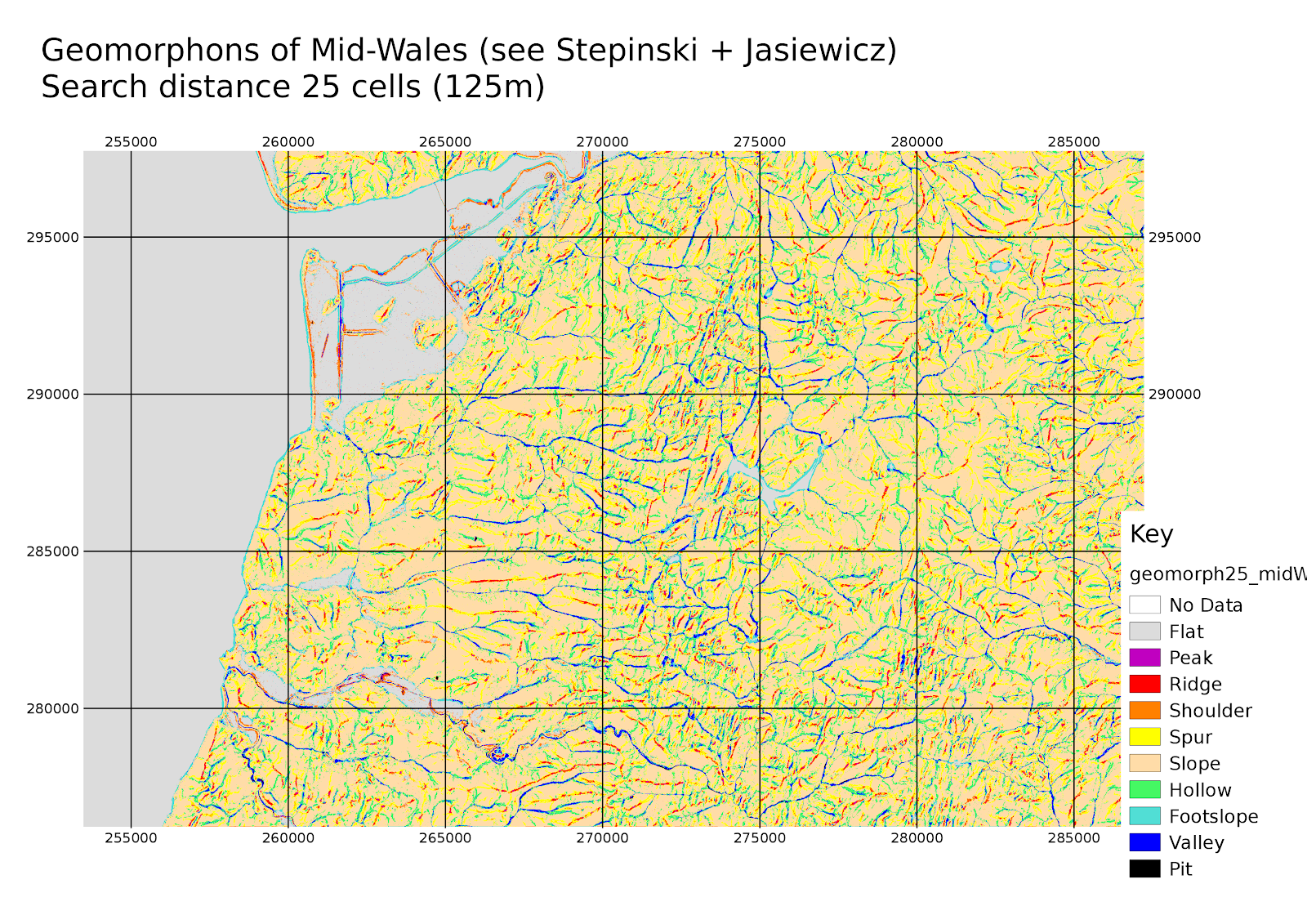
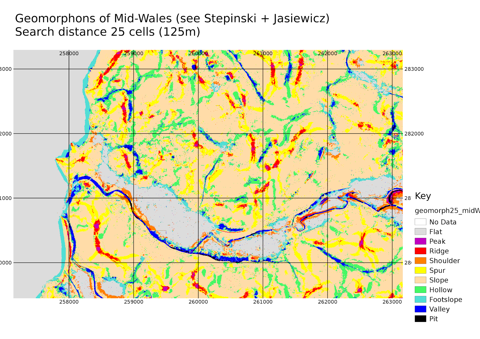
Geomorphons of mid-Wales
Following the machine-vision based method of topographic analysis, "Geomorphons" by Stepinski and Jasiewicz, here's an example of the method applied to mid-Wales:
The authors argue that the method can make a useful analysis of topography at differing scales, in a better way than typical differential-geometry based methods do.
A close-up of the Aberystwyth area:
After a number of hours, a wider search area can be made to match the scale of Stepinski and Jasiewicz's map of Poland in their paper , in which the authors used a DEM at 30m resolution at a search radius of 50 cells.


Hopefully I'll have something useful from this method applied to Mars in time to go in my dissertation....
Website: Space Informatics Lab - University of Cincinnati
Segmenting with LandSerf: Wales DEM
Using some more SRTM tiles, I will try segmenting the DEM of Wales, using the elevation, slope, aspect, and several curvature layers generated in LandSerf:

 Here is an example segmentation showing the mid-Wales area with RSGISlib with a minimum object size of 80 pixels (0.2sqkm):

Segmenting Topography with LandSerf and RSGISLib
As a training for segmenting Martian topography, I have done a little work on Earth.
Using the software LandSerf by Prof. Jo Wood (the website www.landserf.org appears to be down at the moment), I created a number of derived topograhic layers from Shuttle Radar Topography mission data, i.e. slope, aspect, and plan, longitudinal, cross-sectional, profile and mean curvature. I then layerstacked these files (taking the aspect in degrees from north-facing).
Using RSGISlib to segment these (using min 128px sized objects where a pixel is ~ 72m) I get results like this:
The curvature layers seem to enable it to segment along ridge and valley lines and it can sometimes be seen how the topography is orientated spatially.
The population of Wales represented as a multicomponent 0-manifold.

Martian glaciers in Crater "Greg"
As mentioned by Hartmann et al., there are a number of glacier-like features in the Martian Crater "Greg".
I am studying Martian glaciers, based on the list published in Souness et al. 2012 for my MSc dissertation.
Here are a couple of graphics, showing the Souness glaciers in the Greg crater:
I have used Google Fusion tables to plot these and exported to a KML for use in Google Earth using the CTX camera mosaic as a backdrop. The centres are plotted as snowflakes, heads in blue and termini in yellow, with purple and green used for the channel sides at the midpoint.

Below, I have tried using RSGISlib on Mars, using a layerstack combining topography and imagery from Mars Express HRSC, using a colour palette to show a segmentation. I'm not yet convinced the segmentation is picking them out, but work continues...

« Prev
1
2
3
4
5
6
7
8
9
10
11
12
13
14
15
16
17
18
19
20
21
22
23
24
25
26
27
28
29
30
31
32
33
34
35
36
37
38
39
40
41
42
43
44
45
46
47
Next »