Skrifennow
My blog, imported from Blogger and converted using Jekyll.
Dec 28, 2015
Detailing the Souness GLFs which have a large offset between the quoted centre, or are duplicates, or have been visually identified as potentially having a typographic error, I now continue with the southern hemisphere.
Argyre
see also
previous post.
S732, S809
 |
| Souness 732 in the wall of crater Arkhangelsky at 24°W, 41°S has an off-centre 'centre' position, but does not have HRSC DTM coverage. |
 |
| Souness 809 at 49°S in tile h2508 has a long and sinuous shape where the 'centre' falls outside of the channel. |
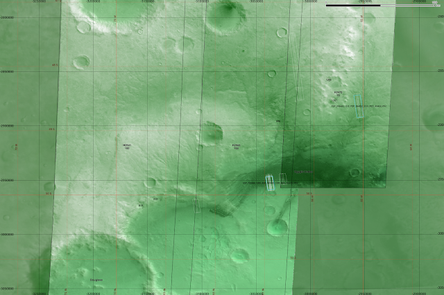 |
| Showing broad context of this area, to the west of Argyre Planitia, a system of valleys is seen, along with dunes. |
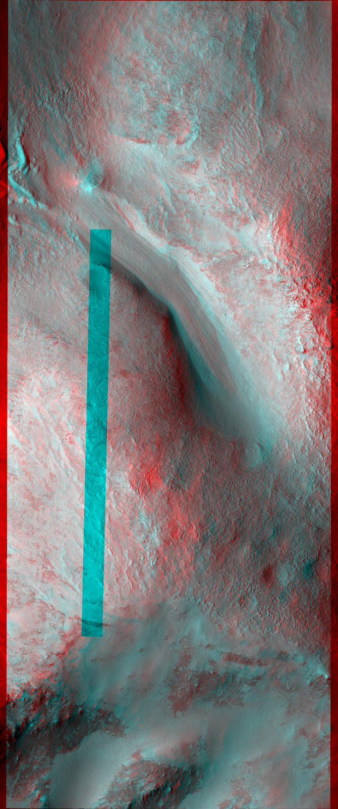
It is possible that Souness 809 is an example of a glacier forming in a pre-existing older fluvial valley system.
West Hellas
see also
previous post.
S1124, S1145, S1175, S1183, S1188, S1189, S1197, S1237, S1253/S1309:
 |
| Souness 1124 in an unnamed crater not covered by a HRSC DTM. |
 |
| Souness 1145 also falls outside of HRSC DTM coverage. |
 |
| Souness 1175 is among many GLFs around the walls of a crater. |
 |
| Souness 1197 is found on the north wall of a crater where the floor is covered by a dune system. |
 |
| Souness 1237 on the southern wall of crater 'Russell' which contains a system of dunes. |
 |
| Crater Russel at ~ 55°S, 13°E. |
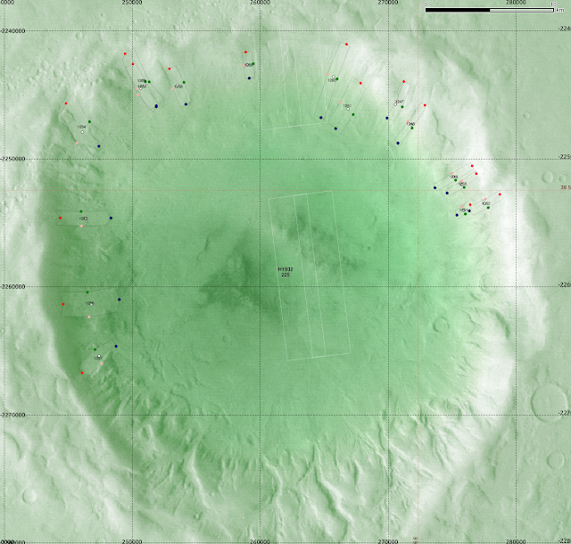 |
| S1253/S1309 are duplicates in this crater containing many GLFs at 38°S, 16°E. |
East Hellas
see also
previous post.
S950/S1271, S951/S1272, S978/S1274 , S999/S1278, S1000/S1277, S1016, S1073/S1294, S1085/S1292, S1098/S1297, S1107/S1298, S1117/S1301, S1275, S1300.
 |
| Souness 950 is a duplicate with Souness 1271 and S951 with S1272 in the north wall of Greg crater. |
 |
| A wider view, also showing the duplicates S978/S1274 |
 |
| Souness 978 and 1274 are duplicates and another two Souness GLFs are found around a mesa to the NW of Greg crater at ~ 111°E, 37°S. |
 |
| Souness 999 and 1000 are duplicates with S1278 and S1277 in an interesting region covered previously. |
 |
| Broader context for S999/1278, S1000/1277 near Reull Vallis which is at the NW of this image. Souness 1275 is seen at the S of this image. |
 |
| S1016 is out of HRSC DTM coverage on a piece of raised terrain with Souness GLFs on both north and south facing sides at 41.5°S, 105°E. |
 |
| Broader context for S1016. |
 |
| S1073 and S1085 are duplicates with S1294 and S1292. |
 |
| Broader context for Souness 1073/1294 and Souness 1085/1292. Souness 1098/1297 is also seen. |
 |
| Souness 1098 is a duplicate with S1297. |
 |
| Souness 1107/1298 is seen in a shadowed area on the margin of Reull Vallis itself. It is covered by an anaglyph PSP_001978_1445. |
 |
| Souness 1117 is a duplicate with S1301 and the malformed S1300 (typo for the 'head' location?) also overlaps. |
 |
| Souness 1275. The centre is displaced out of the outline of the extent due to the glacier flowing around the topography. |
Southeastern Highlands
see also
previous post.
S1270
 |
| Souness 1270 within a crater at 169°E 46°S. |
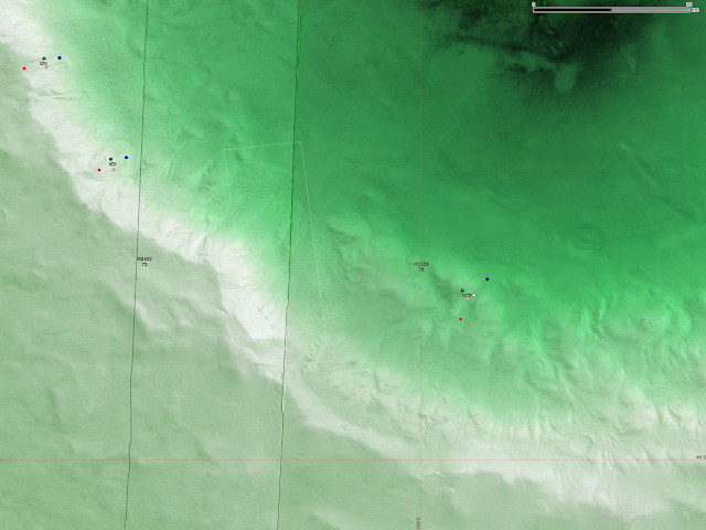 |
| Zooming into the crater wall. |
Conclusion
For the purposes of the Bayesian classifier, I believe that only 2 of the 1309 GLFs would have been particularly problematic, S359 and S1300. The naive assumption of constant channel width does add in some of the wall terrain anyway, even if the 'centre' is still within the 'extent'. These two would be the only ones to be worth manually correcting for my purposes.
I think it could be beneficial is to retrain the classifier with the 'centre' areas only, i.e. use only the terrain elements that overlap with the centre of each GLF. Theoretically, the 'head' areas should be the terrain that governs accumulation of glaciers, and this I have already done.
An extended investigation could be to take (some?, all?) of the GLFs and try to draw a profile of the mid-line using best available imagery and then try to draw conclusions based on this.
Dec 26, 2015
In the
Souness et al. 2012 paper, a catalog is presented with the various glacier-like-forms identified.
In my analysis, I assume a constant channel width, which is not always a good assumption, and in a few cases, there are duplicates, or what appears to be a possible typographic error. There are only a few out of the 1309 which are likely to be affected.
I have identified some of these in the
spreadsheet at this link.
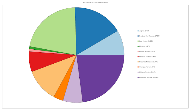
I show the count of Souness GLFs by the
regions I used earlier:
There are only relatively few that look like they have a typographical error, for example Souness 359, and Souness 1300:
 |
| Red dot shows 'head', white 'centre' and dark blue 'terminus' |
 |
| S1117 and S1301 are duplicates and S1300 appears to contain a typo |
I decided to go through systematically, and look at Souness objects that either looked odd in shape visually, or had a distance between the 'centre' recorded by Souness and the middle of the channel that was more than the channel width.
I below detail the individual Souness objects where there is some kind of query, either being a duplicate or centre out of the mid-channel. In Google Earth, I show heads in blue, termini in yellow, the 'centre' with a snowflake, and left and right mid-channel in magenta and green.
Overall, I don't think this on its own will have made a lot of difference to the classifier, since any DEM segments that overlap the extent would be chosen for the input, and a little more conservative 'extent' for those Souness GLFs that currently include non-glacial terrain would not likely make a decisive difference.
Northern Hemisphere
North of Olympus Mons
See also
previous post.
In this area, Souness objects 87, 87, 96 and 108 stand out as odd-shaped.
 |
| Location, with the four Souness objects noted highlighted in yellow. |
 |
| Souness 87 and 88 overlap significantly near the edge of h0037. Souness 91 and 92 are also visible. |
 |
| Oblique view in Google Earth showing S87, 88, 91 and 92. |
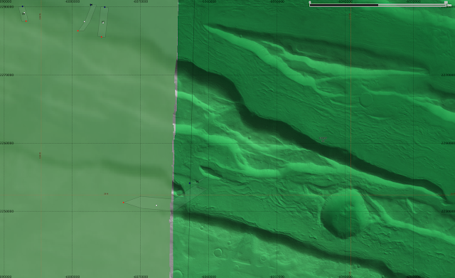 |
| Souness 96 starts outside the HRSC tile h0037's area of coverage and joins what looks like a larger valley fill glacial form. The crater also appears to have glacial features infilling it, that are not catalogued by Souness. |
 |
| Souness 96 looking west with CTX imagery in Google Earth. |
 |
| Looking down on S96 with CTX imagery. There are other glacial like forms not catalogued by Souness since his intention was to catalogue analogues of valley-glaciers on Earth. In this area of Mars, recent (last few Myr) glacial activity is believed to be superimposed on an older landscape of the larger topographic forms. |
 |
| S108 is outside any HRSC DTM tile. |
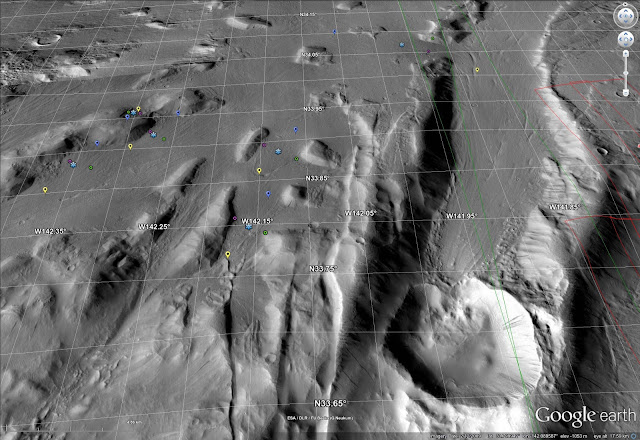 |
| The same area, in Google Earth. Note the slope liniae in the crater at lower-right. These may be the result of current episodic brine flows. |
 |
| Zooming in on S108, a slope line is seen on the slope constraining it topographically. |
Mareotis Fossae area
See also
previous post.
 |
| Souness 12 in context within HRSC DTM tile h5401. |
 |
| Souness 12 looking NW in an oblique CTX image mosaic. It is an interesting question why exactly Souness 12 is formed where it is when to the right gullies cover the slope instead. |
 |
| Souness 47 (left) and Souness 31 (right). 46°N, 82-85°W. |
 |
| Souness 44 at upper-left, with S43 and S45 nearer the centre. |
 |
| Souness 47. |
 |
| Souness 38 amid a glaciated landscape. |
 |
| Souness 31 and 32 (north to south). |
 |
| Souness 11, 12, and 14 within context showing Bayesian classifier result. |
 |
| Souness 47 (left) and Souness 31 (right) with S43, 44, 45, 38 and 32 also shown. See also same area in previous post. 46°N, 82-85°W. |
Deuteronilus Mensae
See also
previous post.
In this area S6, 590, 617, 618, 634, 693, 708, 720, and 724 either have a markedly off-centre 'centre' or are duplicates.
 |
| Souness 6. 30°N, 11°W in HRSC tile h1498. |
 |
| Souness 6 CTX images. |
 |
| The duplicated Souness objects S567/578 and S566/577 are shown to the right above. |
 |
| Souness 590 among several objects not covered by any HRSC DTM. |
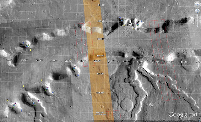 |
| The same GLFs as the previous image, showing CTX images via Google Earth. Perhaps there has been several glacial epochs in the 'recent' times of the last few Myr that have been superimposed on the longer-term formed topographic channel? |
 |
| Souness 617 and 618 among other GLFs along a topographic boundary. |
 |
| S617/S618 |
 |
| Souness 634 at a topographic boundary where it appears there is other glacially reshaped terrain not classified as Souness objects. |
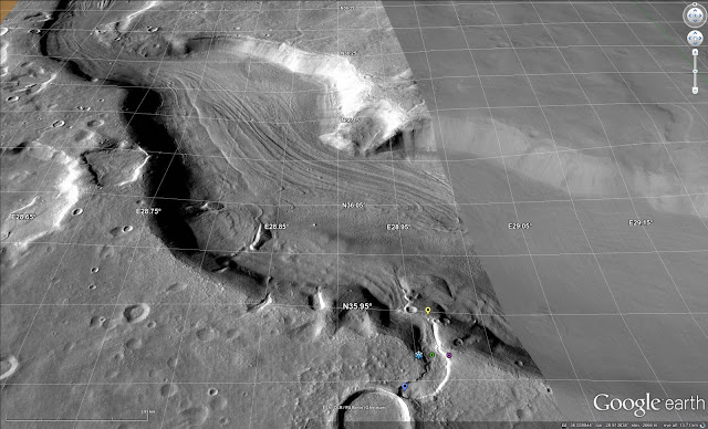 |
| S634 |
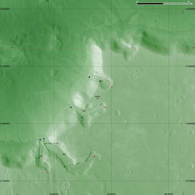
 |
| S634 in broader context. |
 |
| Souness 693 among other GLFs and at least one more uncatalogued example near the top of this field. |
 |
| S693 in context, looking west with CTX imagery. |
 |
| Souness 720 and 693 highlighted. |
 |
| S720 in upper-centre of image. |
 |
| S720. |
 |
| Souenss 708 and 707. |
 |
| Souness 724. |
 |
| S724 oblique view. |
Protonilus Mensae
See also
previous post.
 |
| Souness 337 and 338, along with some further Souness objects. ~ 36N, 57°E. |
 |
| Souness 351 shows an odd shape, and is here depicted with other Souness GLFs. S348 perhaps has a position error, if it is in fact a little to the SW of where it is plotted. ~ 37°N, 56°E. |
 |
| Visualising the Bayesian classifier Ln(K) for extents (blue) and 'head' areas (red). |
 |
| Souness 380. 53°E, 40.5°N. |
 |
| Souness 380, 389 and 390 in context along with a number of others. |
 |
| Souness 389, 390. |
 |
| Souness 400, 401, 402, 403, 404. ~ 52°E, 40°N. |
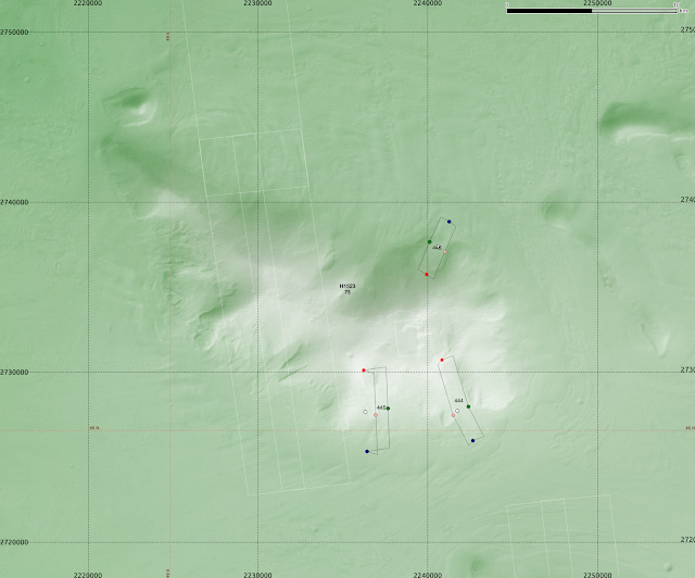 |
| Souness 445 shows an off-centre centre, where two other Souness GLFs are found on a mesa at 49°E, 46°N. |
 |
| Souness 472, 473 and 474. |
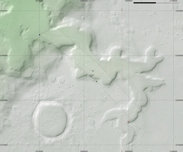 |
| Souness 491. |
Nilosyrtis Mensae
see also
previous post.
 |
| Souness 204 and 205. |
 |
| Souness 230 and 231 merging, along with 2 other Souness GLFs pictured. |
 |
| Souness 245 at the low latitude of 28°N, where most of the surrounding valleys are non-glaciated, or perhaps where glaciers have now ablated. |
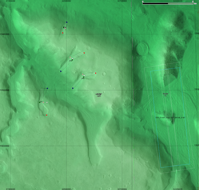 |
| Souness 247 is off-centre, shown here with some surrounding GLFs. |
 |
| Souness 260. |
Phlegra Montes
see also
previous post.
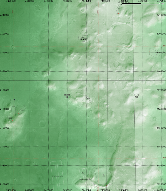 |
| Tiles h1423 and h1412, showing S150 at top, the duplicates S154 and S158 near top, and S156 near the bottom. |
 |
| Souness 156. |
 |
| Duplicates S154 and S158. |
 |
| S156 in an oblique view looking W showing CTX imagery in Google Earth. |
 |
| A higher view showing S156 and the duplicates S154/158. |
 |
| S156, and S159 amid a complex glacial landscape. |
 |
| S156 and S159 |
The southern hemisphere fields are shown in a
post to follow.
Dec 19, 2015
I mentioned previously that I used QGIS to draw lines in the direction of slope, where I had a segmented layerstack which included elevation, slope, aspect and 2 curvature layers (longitudinal and cross-sectional). This was done with
RSGISlib in a similar way to my Mars work.
There was an
bug with QGIS 2.12 that meant the plotting of arrows didn't work but with QGIS 2.12.1 this seems to be working again. It still takes a long time to render with the SVG marker, even with 32GB RAM and a quad-core system.
Here are a few examples:
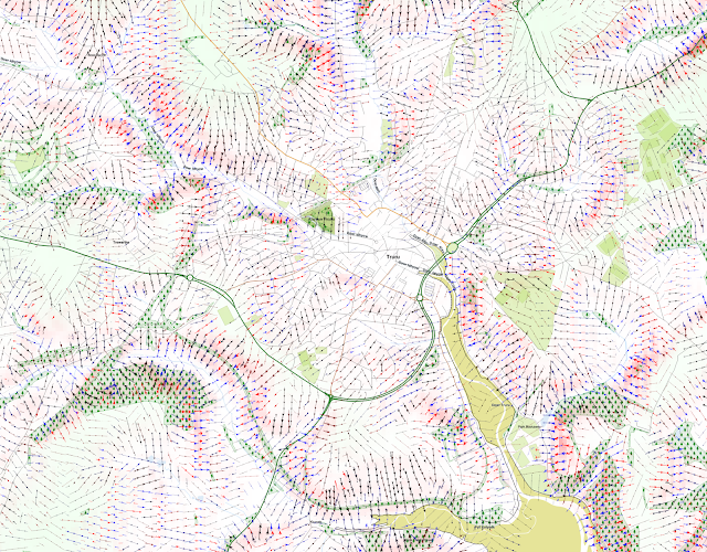 |
| Truro area in Cornwall. The slopes are marked with arrowed lines, with steeper slopes marked more thickly, and red for convex, and blue for concave slopes. |
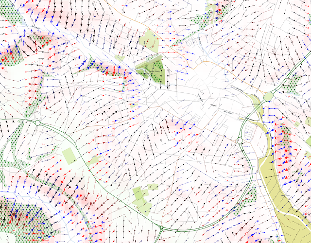 |
| A closer zoom into the city. |
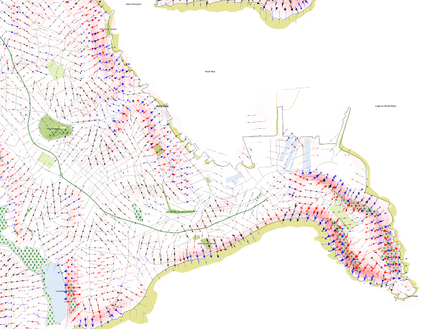 |
| Around Falmouth, including Pendennis Head |
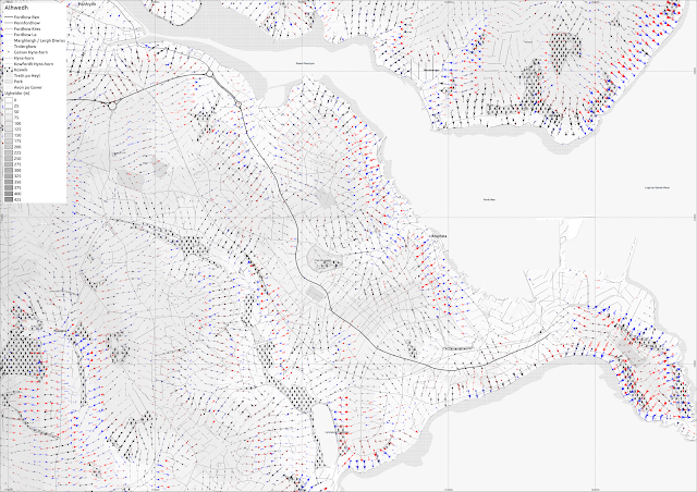 |
| Falmouth again, with grayscale elevation. |
Aberystwyth, Ceredigion, Wales:I show here several QGIS screenshots, at 1:10000 or larger scale, since the rendering of the arrows becomes very slow beyond 1:10000
.
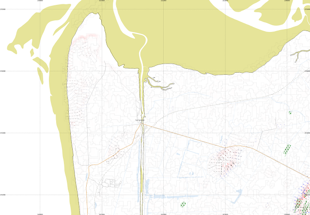 |
| Ynys Las and part of Borth Bog (Cors Fochno). This is mainly a flat area so most segments do not have lines shown. |
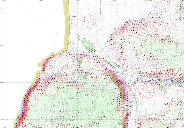 |
| Borth itself, a little to the south |
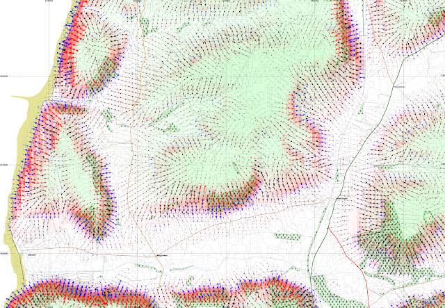 |
| Clarach Bay, and Wallog, and Bow Street |
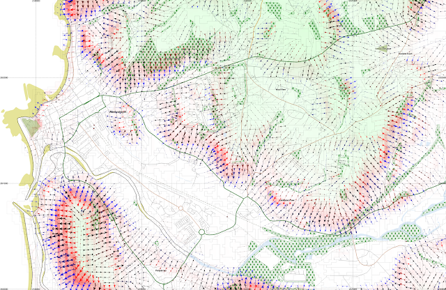 |
| Aberystwyth town and main university campus are here shown, along with Pendinas hillfort, Penparcau, and Llanbadarn Fawr. |
Cadair Idris - a textbook glacial landscape
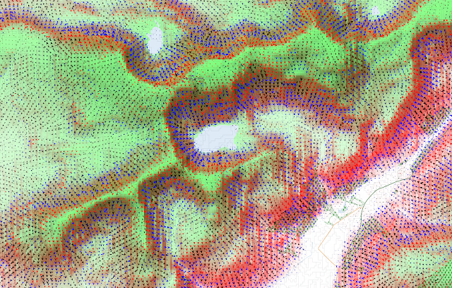 |
| Showing the arrows downslope only. |
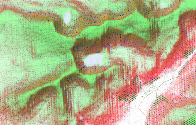 |
| Adding in the slope parallell lines but making the arrowheads smaller. |
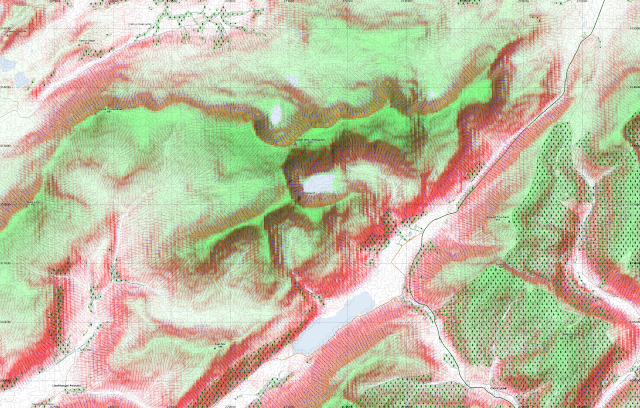 |
| At 1:20000 this takes a long time to render on the map canvas in QGIS. |
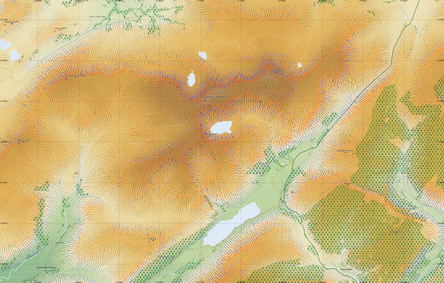 |
| A version with only the lines renders much faster. |
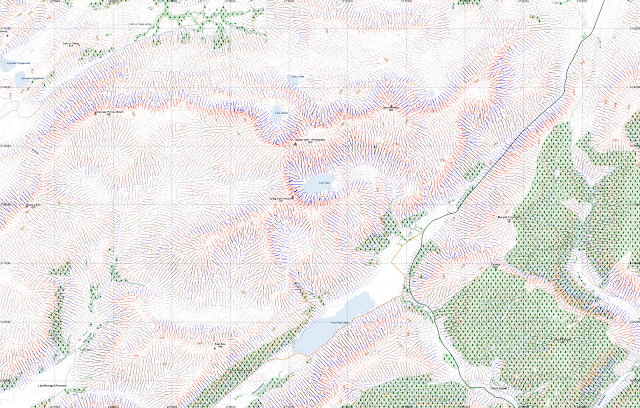 |
| Using contours instead of shading to indicate elevation. |
Dec 16, 2015
The folllowing is my 'Ebrenn y'n nos' (Sky at night in Cornish) contribution that I prepared December 2015. Apologies that I haven't managed to get this recorded for Radyo an Gernewegva and it will be too late now for it to be current.Very late I know, but here is a relatively low quality recorded version. I have had trouble with noise using my own external microphone which I have tried to suppress with filtering in Audacity.
Ottomma rann nowydh kevres "Ebrenn y'n nos" mis-Kevardhu.
Y'n mis ma, yma'n dydhyow an berrha a'n vlydhen. Yma howlsav an gwav 22a mis-Kevardhu pan vydh an howldrevel diworth Kardhinan 0817 ha'n howlsedhes 1617.
Diworth Pluwvaria yn Syllan yth yns an termynow 0821 ha 1626 (pymp mynysenn moy a dhydh) ha diworth Marwyn ogas dhe Bud yns i 0819 ha 1614 (pymp mynysenn le a dhydh). Kardhinan a'n jeves dorles arbennik drefenn eus 8 our poran ynter howldrevel ha howlsedhes.
2000 blydhen kyns Krist, yth o an dydh dhe'n howlsav gwav nebes berra, 0830-1623. Diworth Syllan (49°52') yth esa an jydh 0834-1634 (6ves mis-Genver 2000KK). An le usi an dydh howlsav gwav eth our a-hys a wrussa movya dhe'n north dres an kansvlydhynyow. Yma gans Kardhinan dorles 50°30'.
Yma an planet Yow gweladow y'n ebrenn bora an mis ma, ughel y'n soth kyns an howldrevel. Ev a sev a-dro dhe hanternos, hag a dhrehedhes y vann ughella our po dew kyns an howldrevel.
Meurth ha Gwener a wra omdiskwedhes nebes diwettha. Yow a vydh a-dherag an howl 8ves mis-Meurth 2016, ha Meurth a vydh a-dherag an howl 22a mis-Me 2016.
 |
| Yma Gwener yn Libra, nag yw hi labelys. 19ves mis-Kevardhu, 7 eur myttinweyth. |
Yma kowas sterennow-koedha an mis ma. Yma an 'Geminids' gweladow diworth 7ves-16ves mis-Kevardhu, ha'ga bann yw 14ves mis-Kevardhu. Nosow an 13ves ha'n 14ves a vydh da aga gweles mars yw an ebrenn kler.
Yma an 'Geminids' temmigow doust ha bilennow diworth planetik Phaethon. Y hyll bos bys dhe 80 anedha gwealdow pub our ha traweythyow moy martesen. Yma an niver ughella dhe 1 po 2 eur, mes nyns yw res gortos difun mar dhiwedhes, ymons i gweladow a-hys an nos.
Gwel
astronomynow.com/2015/12/08/get-ready-for-the-geminid-meteor-shower/ dhe gavoes moy a gedhlow.
An loor: kwartron diwettha yw 3a mis-Kevardhu, loer nowydh yw 11a mis-Kevardhu, kynsa kwartron yw 18ves, loer leun yw 25ves – dydh Nadelik. Moy a-dro dhe'n loer leun Nadelikl omma:
astronomynow.com/2015/12/18/see-a-rare-full-moon-on-christmas-day/Yma an lowr nowydh dhe'n bann 'Geminids' ha possybl vydh kavoes erbrenn tewl ragdha.
Yma New Horizons ow mos yn-mes an system howlyek mes kyns henna ev a wra treusnija taklenn grogys Kuiper 2014 MU69 dhe Dy' Kalann 2019.
Data diworth New Horizons a dhiskwedhas 'loskvenydhyow rew' war Bluton, i a welas menydh gans toll orth an penn. Rag an nowodhow a-dro dhodho gwra gweles orth
pluto.jhuapl.edu.
Bys nessa prys ha Nadelik Lowen.
Nov 17, 2015
Here is a graphical index to my posts on the mid-latitude Souness GLFs. These are the objects discussed in
Souness et al. 2012. They are shown in white here but not really visible at this scale. Each box is a link to my previous blog post on that zone. The various Mars Express HRSC tiles where a digital elevation model is available are outlined in black. I have used an equicylindrical coordinate system with standard parallel 40°.
The yellow crosses show the prospective landing sites for ExoMars, the thick one is the primary landing site of
Oxia Planum for a 2019 landing, the two other crosses for
Mawrth Vallis and
Aram Dorsum which remain in contention for a delayed 2021 landing.
Hopefully the boxes are appearing in the right places.
See also a
larger version (1600x800px) of this index page at my website.


